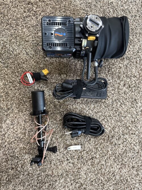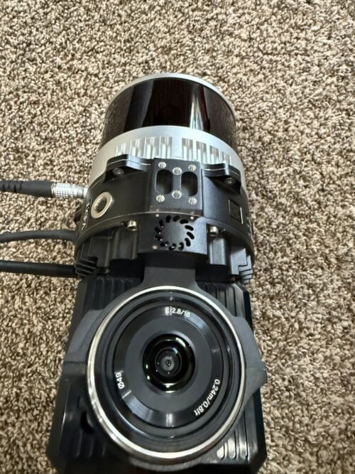
RESEPI Lite XT32 Lidar Full Kit!
RESEPI Lite XT32 DJI mounted kit available now for only $19,500, Save $10,000! (800) 955-3960
2024 RESEPI® Lite XT-32 LiDAR Mapping System
Professional-Grade LiDAR Performance at a Fraction of the Cost
Looking for an affordable way to add professional LiDAR mapping capabilities to your operation? This 2024 RESEPI Lite XT-32 offers the same proven performance as a new system—at a significant savings.
Purchased in July 2024, this system is in very good condition (8/10) and has been well maintained. It includes the DJI drone mounting accessories, making it ready to deploy on compatible DJI platforms.
Sale Price
$19,500 USD
Comparable new system with accessories: Approximately $30,000+
Save over $10,000 without sacrificing performance.
Professional Mapping Performance
The RESEPI Lite XT-32 combines the Hesai XT-32 LiDAR scanner with the proven Inertial Labs RESEPI navigation and sensor fusion platform to deliver highly accurate point clouds for surveying, engineering, construction, mining, and infrastructure applications.
Designed for fast deployment and dependable field performance, the system produces survey-grade results while remaining compact, lightweight, and easy to operate.
Key Features
-
Survey-grade 2–3 cm vertical accuracy
-
2–4 cm precision
-
Advanced point cloud noise reduction (1.5–2.5 cm)
-
High-density 360° LiDAR data collection
-
Lightweight package—approximately 1.7 kg with camera
-
Recommended operating altitude: 100 m AGL
-
Up to 33 minutes of flight time (platform dependent)
-
Integrated WiFi with intuitive web-based operation
-
Onboard Linux processing and data logging
-
Supports RTK/PPK workflows for high-accuracy mapping
Ideal Applications
-
Topographic Surveys
-
Construction Progress Monitoring
-
Stockpile & Volumetric Measurements
-
Mining Operations
-
Utility & Powerline Mapping
-
Transportation Corridors
-
Environmental & Forestry Surveys
-
Infrastructure Inspection
Platform Compatibility
Ready for use with:
-
DJI Matrice 300 RTK
-
DJI Matrice 600 Pro
-
Freefly Alta-X
-
Custom UAV Platforms
-
Vehicle-Mounted Systems
-
Handheld Mapping Configurations
DJI mounting accessories are included with this package.
Why Buy This System?
This is an excellent opportunity to acquire a proven professional LiDAR mapping system without the cost and lead time of purchasing new.
✔ Purchased July 2024
✔ Very Good Condition (8/10)
✔ Complete DJI accessory package included
✔ Immediate availability
✔ Over $10,000 savings compared to a new system
Asking Price
$19,500 USD
A cost-effective solution for surveyors, engineering firms, contractors, and geospatial professionals looking to expand their LiDAR capabilities with a proven, field-ready system.